
Bike Trip GPS Devices
AKA How do I get from A to B?
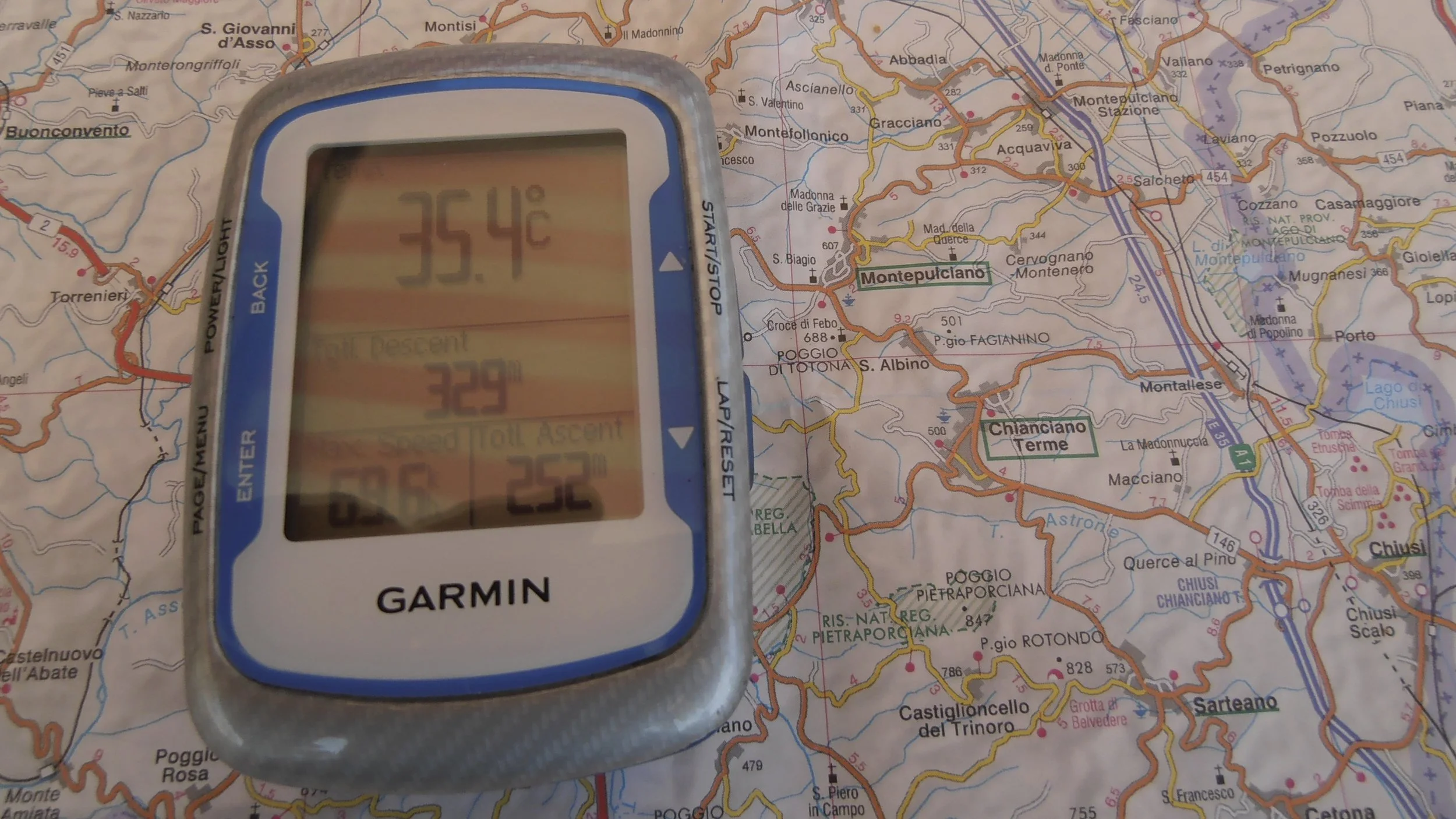
GPS devices are strongly advised for our Alps and Hilly trips.
GPS devices are not really necessary for our two Rolling trips (Provence and Burgundy) as you will be riding with a guide most of the time. However, being able to self-navigate opens up a world of possibilities. No, getting lost is not one of them.
Did you know that your Smartphone can also act as a GPS device on your bike? Since 2019 all of our groups have used the Ride with GPS App and the overwhelming comment was “this is great!” Stick your phone in your pocket and it will tell you to turn right, left or continue straight at the next intersection. This is one of the biggest and best changes that we have seen in years! You will need to provide a “Phone Specific” mount if you wish to have your phone on your handlebars. Here is a link to a good solid product that will do that job, and it has been tested by many of our clients.
At TTT we do not insist that our guests ride in a clump; meaning the fast and slow riders all together in a 5 kilometer long, stretched-out group. This causes nothing but stress for the slow riders and impatience for the faster ones.
Ideally, for complete independence on any of our trips, you should have a GPS device and be well versed in its use. Failing that, the Ride with GPS app on your phone is fantastic, works well and is free. It is very easy to use without the steep learning curve associated with cycling specific GPS devices, such as Garmins, Wahoo and Hammerheads.
This gives you the freedom to ride at your pace and the distances that you want. During our “Rolling” or “Hilly” trips however, normally the group follows the guide, as this simplifies your navigation and the ride is much more of a social affair. Because our trips are created for small harmonious groups, we tend to have riders of a similar speed on each trip, and bear in mind that none of our trips are a "race.” Plus, our support vehicle is most likely nearby.
E-Bikes … the game-changer!
See our section on E-Bikes if you or people in your group have differing speeds. Also please go to our Van Support page to fully understand the support options.
Riders in diverse groups who want to ride faster or cover more distance than the core group can do so. But you will be for the most part, riding unsupported and self - navigating with your Garmin, Smartphone and/or one of our custom maps. Our leisure trips in Provence and Burgundy have guided ride extensions that occur after the core group reaches the hotel in the afternoon.
If you have never used a GPS device on your bike and wish to purchase a device, give us a call, as we can help you sort through the jungle of devices that are out there. Then we can help you learn to use your device before your trip. One of the best sites that explains everything that you ever wanted to know about a Garmin is here.
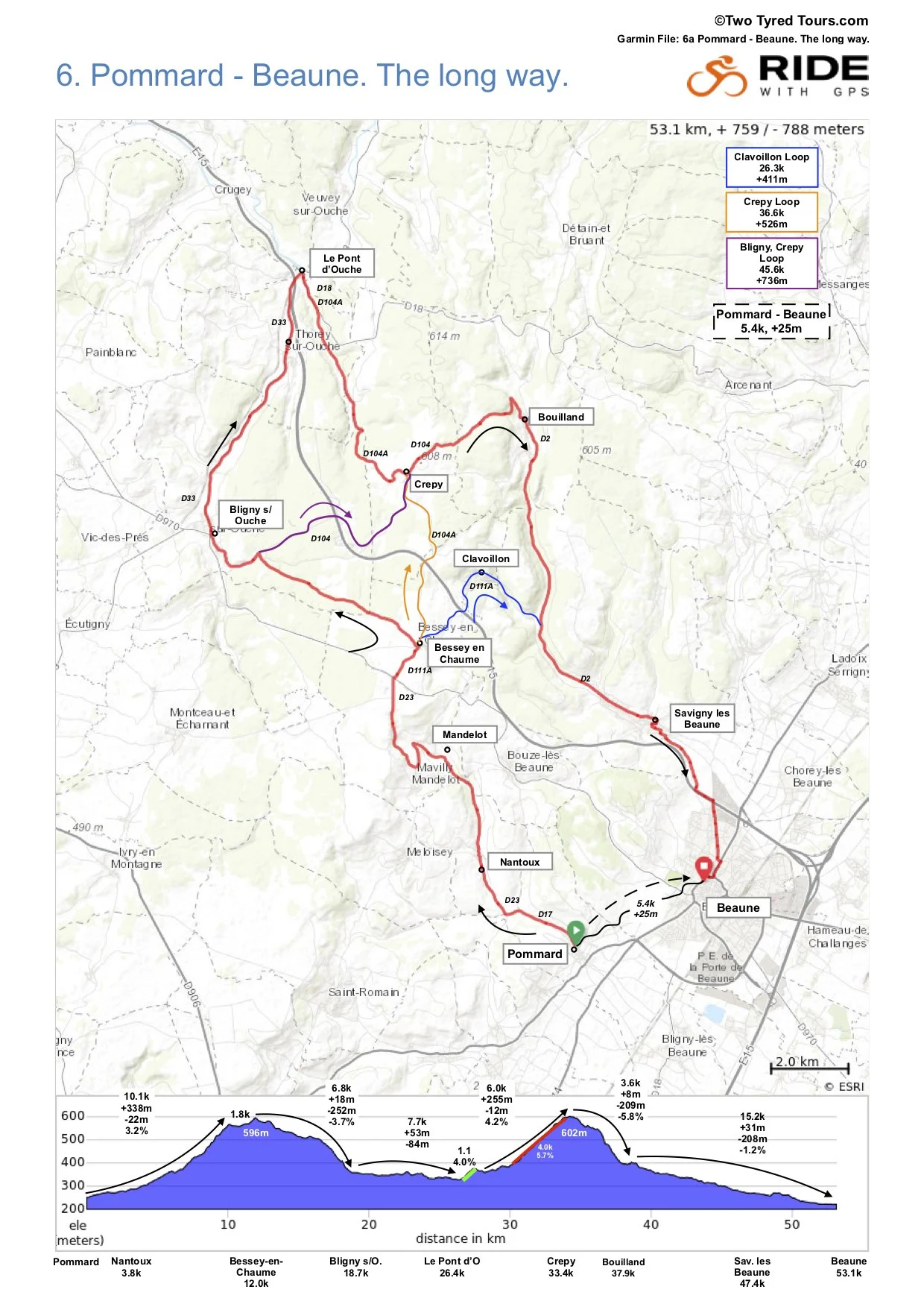
We also provide our riders with one our custom maps (example below) with ride options and profiles as well as a down-loadable route for your own GPS device.
Cycling Route Map in Burgundy
The map below is unique in that it offers (too?) many choices for the next days ride. Most days you might have two or three routes to choose from, rarely five choices.
Each evening you will receive the following day’s route map, like one above. This will cause some of you to not sleep at all and worry about every little bump in the profile before tomorrow’s ride. Those of you that are good with numbers generally spend a sleepless night with a calculator making sure that the distances all add up correctly. ;-)
The above map shows the route options from Pommard to Beaune on one of our lovely Burgundy trips. The Base Route, always in red on our maps, is 53.1k and you will gain 759m and descend 788m during the ride. This is noted top right. Base route Ride Profile is at the bottom with the ride broken down into logical segments. These segments also depict the % gradient over a selected distance. As a general rule, anything less than a 5% grade is just fine. While over 5% you may break a sweat. There will be objectors to the last two statements.
Route Options 1, 2, 3 and 4 start by following the red line (base route) north from the hotel in Pommard then deviate on a road in a colour that corresponds to the coloured boxes top right. each optional route then joins back into the red line or base route to finish. Option 5 is somewhat self explanatory.
How to read our maps.
Option 1: Base Route - Red Line the entire route. Total ride is 53.1k and 759m total elevation gain.
Option 2: Blue box top right and Blue line. Total ride is 26.3k and 411m total elevation gain.
Option 3: Yellow box top right and Yellow line. Total ride is 36.6k and 525m total elevation gain.
Option 4: Purple box top right and Purple line. Total ride is 45.6k and 736m total elevation gain.
Option 5: Black line. Minimal riding. Total ride is 5.4k to the next hotel and 25m of elevation gain. We call it the Wine Tasting Time Trial. Get to Beaune well before lunch and become a Burgundian wine expert by 3pm while your friends are still slogging up the hills.
Just about all of our rides on every TTT trip have options like the map above. Sometimes there may only be one or two options as the ride options are terrain and road dependent.
Popular question. Where is the support van if the group splits and has people riding on all 5 routes?
a.The van will follow the biggest group.
b. Or the group that the guide deems that may need assistance or would feel more comfortable with the support van nearby.
c. Or the van is in the area and stays in contact with you via your cell phone if a problem arises. Either way we are not that far away and we can also track where you are. Ask us how we pull off that magic.
d. Or, all of the above.
e. Route Option 5: Probably not needed. But we are nearby if you need help choosing a wine.